
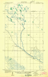
1931 Map of Driggs Lake NE
USGS Topo · Published 1931About this map
The Fox River meanders across the marshy terrain of this 1931 survey, which covers the borderlands of Alger and Schoolcraft counties. This particular sheet was an advance copy, utilizing aerial photography from the U.S. Army Air Corps to document a landscape defined by complex hydrology and narrow transit routes. A series of interconnected water bodies, including Deerfoot Lake, Owl Lake, and Taylor Lake, dominate the northern section, while the southern reach is marked by the sharp bend known as Little Devils Elbow.
Find a feature on this map
12 named features on this map. Tap any name to fly to it.
Don’t see what you’re looking for? This feature index may not catch every label — zoom into the map to look around manually.
Map Details
Editions of this 1931 Driggs Lake NE Map
2 editions found
Other maps of this area

1931 · Seney SW
USGS Topo · 1:31,680

1931 · Seney NW
USGS Topo · 1:31,680

1931 · Driggs Lake NW
USGS Topo · 1:31,680

1931 · Driggs Lake SW
USGS Topo · 1:31,680

1931 · Driggs Lake SE
USGS Topo · 1:31,680

1954 · Sault Sainte Marie
USGS Topo · 1:250,000

1956 · Sault Sainte Marie
USGS Topo · 1:250,000

1957 · Sault Sainte Marie
USGS Topo · 1:250,000

1958 · Sault Sainte Marie
USGS Topo · 1:250,000

1958 · Marquette
USGS Topo · 1:250,000