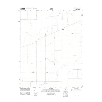
2012 Map of Saunders
USGS Topo · Published 2012About this map
Saunders stands as a primary point of reference in this corner of Stanton County, where the high plains landscape is defined by an extensive grid of county roads and vital water management. The terrain is drained by the winding courses of Bear Cr and Sand Arroyo Cr, which meander through the prairie towards significant local impoundments. Among these are the Hoopengarner SW-1 Reservoir and Hoopengarner SW-4 Reservoir, reflecting the essential nature of water storage in this semi-arid agricultural region. To the south, Burchfield Lake and the Konantz Cem provide anchor points for local history and genealogy, marking the enduring presence of families on the land. The meticulous road network, including routes like Co RD 56 and W Road 19, illustrates the organized expansion of Kansas farming and ranching during the early twenty-first century.
Find a feature on this map
26 named features on this map. Tap any name to fly to it.
Don’t see what you’re looking for? This feature index may not catch every label — zoom into the map to look around manually.
Map Details
Editions of this 2012 Saunders Map
This is the sole edition of this map. No revisions or reprints were ever made.
Other maps of this area

1891 · Albany
USGS Topo · 1:125,000

1892 · Vilas
USGS Topo · 1:125,000

1893 · Albany
USGS Topo · 1:125,000

1900 · Syracuse
USGS Topo · 1:125,000

1920 · Syracuse
USGS Topo · 1:125,000

1955 · La Junta
USGS Topo · 1:250,000

1955 · Dodge City
USGS Topo · 1:250,000

1958 · La Junta
USGS Topo · 1:250,000

1958 · Dodge City
USGS Topo · 1:250,000

1959 · Dodge City
USGS Topo · 1:250,000