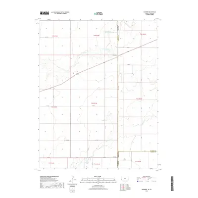
2018 Map of Saunders
USGS Topo · Published 2018About this map
Saunders serves as the primary focal point of this 2018 survey, situated on the high plains near the intersection of the Colorado and Kansas state line. This borderland region is characterized by a sparse network of county roads, such as Co Rd 57 and Co Rd LL, which weave through a landscape shaped by intermittent watercourses. The northern portion of the quadrangle features the Bear Creek drainage, while the southern reaches are marked by Sand Arroyo Cr.
Find a feature on this map
37 named features on this map. Tap any name to fly to it.
Don’t see what you’re looking for? This feature index may not catch every label — zoom into the map to look around manually.
Map Details
Editions of this 2018 Saunders Map
This is the sole edition of this map. No revisions or reprints were ever made.
Other maps of this area

1891 · Albany
USGS Topo · 1:125,000

1892 · Vilas
USGS Topo · 1:125,000

1893 · Albany
USGS Topo · 1:125,000

1900 · Syracuse
USGS Topo · 1:125,000

1920 · Syracuse
USGS Topo · 1:125,000

1955 · La Junta
USGS Topo · 1:250,000

1955 · Dodge City
USGS Topo · 1:250,000

1958 · La Junta
USGS Topo · 1:250,000

1958 · Dodge City
USGS Topo · 1:250,000

1959 · Dodge City
USGS Topo · 1:250,000