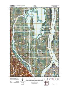
2011 Map of Sauvie Island
USGS Topo · Published 2011About this map
Sauvie Island dominates this 2011 survey, showing a landscape defined by the complex hydrology of the Columbia River and the Multnomah Channel. This specific era captures the island's intricate network of water bodies, from the expansive Sturgeon Lake and Marquam Lake to the smaller Wagonwheel Hole and Seal Lake. The map reveals a history of river-based commerce and navigation, marked by numerous landings such as Chapman Landing, Johnson Landing, and Blurock Landing. Genealogists and local historians can locate the Moar Cemetery and trace early settlements like Burlington and Holbrook along the western rail lines. The presence of the Marquam Dry Lake Canal and various sloughs illustrates the long-standing efforts to manage the water levels of this fertile alluvial plain, while the Sauvie Island Bridge provides the vital modern link to the mainland near Portland.
Find a feature on this map
98 named features on this map. Tap any name to fly to it.
Don’t see what you’re looking for? This feature index may not catch every label — zoom into the map to look around manually.
Map Details
Editions of this 2011 Sauvie Island Map
This is the sole edition of this map. No revisions or reprints were ever made.
Other maps of this area

1897 · Portland
USGS Topo · 1:62,500

1905 · Portland
USGS Topo · 1:62,500

1915 · Hillsboro
USGS Topo · 1:62,500

1918 · Hillsboro
USGS Topo · 1:62,500

1922 · St. Helens
USGS Topo · 1:62,500

1940 · Hillsboro
USGS Topo · 1:62,500

1940 · Portland
USGS Topo · 1:62,500

1940 · La Center
USGS Topo · 1:62,500

1941 · St Helens
USGS Topo · 1:62,500

1943 · St Helens
USGS Topo · 1:62,500