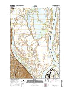
2017 Map of Sauvie Island
USGS Topo · Published 2017About this map
Sauvie Island dominates this 2017 landscape at the confluence of the Columbia River and Willamette River, revealing a complex network of sloughs, lakes, and channels. The island's interior is defined by significant water bodies such as Sturgeon Lake, Marquam Lake, and the aptly named Wagonwheel Hole, while the Gilbert River and Multnomah Channel provide essential drainage. Along the western bank, the Burlington Northern Santa Fe RR parallels the foot of the Tualatin Mountains, connecting the small settlements of Burlington, Holbrook, and Folkenberg. Genealogical interest is anchored by the Moar Cem near Fort William Bend, marking early pioneer presence in this fertile delta. The transition from industrial Portland in the southeast to the expansive wildlife habitats of the northern island, including Guiles Lake and North Arm, illustrates the dual nature of this riverine environment where the Oregon and Washington border follows the main river channel.
Find a feature on this map
102 named features on this map. Tap any name to fly to it.
Don’t see what you’re looking for? This feature index may not catch every label — zoom into the map to look around manually.
Map Details
Editions of this 2017 Sauvie Island Map
This is the sole edition of this map. No revisions or reprints were ever made.
Other maps of this area

1897 · Portland
USGS Topo · 1:62,500

1905 · Portland
USGS Topo · 1:62,500

1915 · Hillsboro
USGS Topo · 1:62,500

1918 · Hillsboro
USGS Topo · 1:62,500

1922 · St. Helens
USGS Topo · 1:62,500

1940 · Hillsboro
USGS Topo · 1:62,500

1940 · Portland
USGS Topo · 1:62,500

1940 · La Center
USGS Topo · 1:62,500

1941 · St Helens
USGS Topo · 1:62,500

1943 · St Helens
USGS Topo · 1:62,500