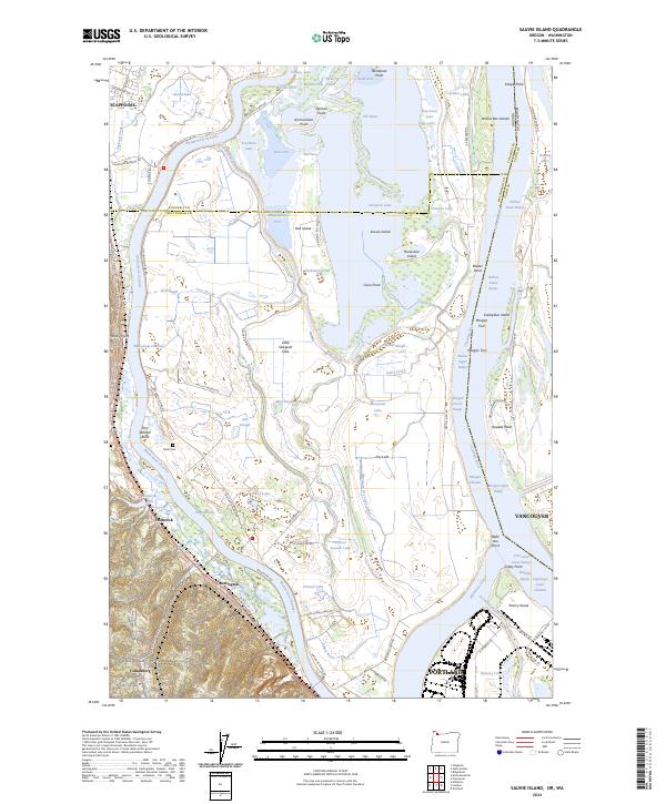
2024 Map of Sauvie Island
USGS Topo · Published 2024About this map
Sauvie Island dominates this landscape at the confluence of the Willamette and Columbia Rivers, defined by a complex network of sloughs, lakes, and seasonal wetlands. The internal drainage of the island is marked by Sturgeon Lake and the Gilbert River, while the western boundary is traced by the Multnomah Channel. This 2024 data reveals the persistent agricultural and conservation patterns of the island, including the Moar Cem and the extensive Ridgefield National Wildlife Refuge to the northeast.
Find a feature on this map
116 named features on this map. Tap any name to fly to it.
Don’t see what you’re looking for? This feature index may not catch every label — zoom into the map to look around manually.
Map Details
Editions of this 2024 Sauvie Island Map
This is the sole edition of this map. No revisions or reprints were ever made.
Other maps of this area

1897 · Portland
USGS Topo · 1:62,500

1905 · Portland
USGS Topo · 1:62,500

1915 · Hillsboro
USGS Topo · 1:62,500

1918 · Hillsboro
USGS Topo · 1:62,500

1922 · St. Helens
USGS Topo · 1:62,500

1940 · Hillsboro
USGS Topo · 1:62,500

1940 · Portland
USGS Topo · 1:62,500

1940 · La Center
USGS Topo · 1:62,500

1941 · St Helens
USGS Topo · 1:62,500

1943 · St Helens
USGS Topo · 1:62,500