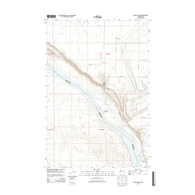
2014 Map of Savage Island
USGS Topo · Published 2014About this map
The Columbia River carves through this reach of the Pacific Northwest, defining the boundary between Franklin Co and Benton Co. The landscape is dominated by the broad course of the river and the prominent Savage Island situated within its flow. Inland from the eastern banks, the terrain rises toward Ringold Flat, where specialized water features like the Ringold Springs Fish Pond and Ringold Pond indicate local aquaculture or conservation efforts.
Find a feature on this map
23 named features on this map. Tap any name to fly to it.
Don’t see what you’re looking for? This feature index may not catch every label — zoom into the map to look around manually.
Map Details
Editions of this 2014 Savage Island Map
This is the sole edition of this map. No revisions or reprints were ever made.
Other maps of this area

1917 · Pasco
USGS Topo · 1:125,000

1924 · Hanford
USGS Topo · 1:62,500

1925 · Scooteney Lake
USGS Topo · 1:62,500

1951 · Scooteney Lake
USGS Topo · 1:62,500

1951 · Richland
USGS Topo · 1:62,500

1951 · Hanford
USGS Topo · 1:62,500

1953 · Walla Walla
USGS Topo · 1:250,000

1958 · Walla Walla
USGS Topo · 1:250,000

1965 · Mesa
USGS Topo · 1:62,500

1965 · Eltopia
USGS Topo · 1:62,500