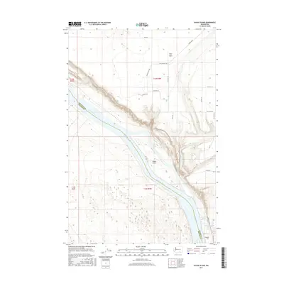
2017 Map of Savage Island
USGS Topo · Published 2017About this map
Savage Island sits prominently in the Columbia River, marking a central point in this stretch of the river valley where the border of Franklin and Benton counties follows the main channel. The landscape on the eastern shore is defined by the broad Ringold Flat, a significant riverside terrace that hosts the Ringold Pond and the Ringold Springs Fish Pond. The map reveals an intricate network of irrigation and drainage infrastructure, most notably the W-B Five Wasteway which cuts through the terrain toward the river. Upland from the water, the plateau is partitioned by rural routes such as Basin Hill Rd and Mountain Vista Rd, supporting local aviation at the Green Acres Airport. This survey provides a clear view of the modern agricultural and hydrological management of the Hanford Reach area.
Find a feature on this map
26 named features on this map. Tap any name to fly to it.
Don’t see what you’re looking for? This feature index may not catch every label — zoom into the map to look around manually.
Map Details
Editions of this 2017 Savage Island Map
This is the sole edition of this map. No revisions or reprints were ever made.
Other maps of this area

1917 · Pasco
USGS Topo · 1:125,000

1924 · Hanford
USGS Topo · 1:62,500

1925 · Scooteney Lake
USGS Topo · 1:62,500

1951 · Scooteney Lake
USGS Topo · 1:62,500

1951 · Richland
USGS Topo · 1:62,500

1951 · Hanford
USGS Topo · 1:62,500

1953 · Walla Walla
USGS Topo · 1:250,000

1958 · Walla Walla
USGS Topo · 1:250,000

1965 · Mesa
USGS Topo · 1:62,500

1965 · Eltopia
USGS Topo · 1:62,500