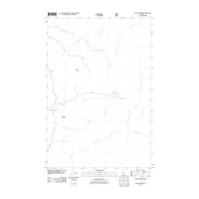
2011 Map of Savage Ridge
USGS Topo · Published 2011About this map
Colt Killed Creek dominates the drainage patterns of this high Idaho County backcountry, where the rugged terrain is defined by Savage Ridge and Tamarack Mountain. The landscape is primarily shaped by a dense network of tributaries including Big Sand Creek, Rabbit Creek, and Storm Creek, which carve through the wilderness of the Clearwater region. Human activity is centered around the few accessible points along the western edge, notably at the Colt Creek Campground and via the winding path of Hoodoo Lake Rd. The presence of the Colt Creek Cabin suggests a legacy of seasonal use, whether for forestry, monitoring, or backcountry travel. The survey details the intricate intersections of small watercourses like Alkire Creek and Swamp Creek, providing a technical look at the area's hydrology before these remote drainages feed into larger river systems.
Find a feature on this map
16 named features on this map. Tap any name to fly to it.
Don’t see what you’re looking for? This feature index may not catch every label — zoom into the map to look around manually.
Map Details
Editions of this 2011 Savage Ridge Map
This is the sole edition of this map. No revisions or reprints were ever made.
Other maps of this area

1901 · Hamilton
USGS Topo · 1:125,000

1911 · Lolo
USGS Topo · 1:250,000

1912 · Missoula
USGS Topo · 1:125,000

1913 · Lolo
USGS Topo · 1:250,000

1956 · Hamilton
USGS Topo · 1:250,000

1959 · Hamilton
USGS Topo · 1:250,000

1960 · Hamilton
USGS Topo · 1:250,000

1964 · Hamilton
USGS Topo · 1:250,000

1964 · Rocky Point
USGS Topo · 1:24,000

1964 · Roundtop
USGS Topo · 1:24,000