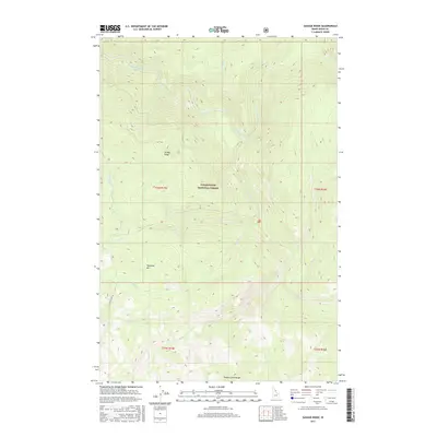
2017 Map of Savage Ridge
USGS Topo · Published 2017About this map
Clearwater National Forest dominates this mountain landscape, defined by high elevation divides and a dense drainage network. The topography is anchored by Savage Ridge in the north and Hidden Creek Ridge in the south, with Tamarack Mtn rising between them. The map documents a complex system of waterways feeding into the larger drainage, including Colt Killed Creek, Big Sand Cr, and the appropriately named Swamp Cr.
Find a feature on this map
22 named features on this map. Tap any name to fly to it.
Don’t see what you’re looking for? This feature index may not catch every label — zoom into the map to look around manually.
Map Details
Editions of this 2017 Savage Ridge Map
This is the sole edition of this map. No revisions or reprints were ever made.
Other maps of this area

1901 · Hamilton
USGS Topo · 1:125,000

1911 · Lolo
USGS Topo · 1:250,000

1912 · Missoula
USGS Topo · 1:125,000

1913 · Lolo
USGS Topo · 1:250,000

1956 · Hamilton
USGS Topo · 1:250,000

1959 · Hamilton
USGS Topo · 1:250,000

1960 · Hamilton
USGS Topo · 1:250,000

1964 · Hamilton
USGS Topo · 1:250,000

1964 · Rocky Point
USGS Topo · 1:24,000

1964 · Roundtop
USGS Topo · 1:24,000