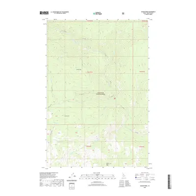
2020 Map of Savage Ridge
USGS Topo · Published 2020About this map
Clearwater National Forest encompasses this high-elevation landscape in Idaho County, where a complex network of waterways flows from prominent divides. The topography is defined by major elevations such as Tamarack Mtn and the long spine of Savage Ridge, which separates the drainages of Savage Cr and Colt Killed Creek. This area illustrates a backcountry road system managed for forestry and conservation, with corridors like Hoodoo Lake Rd and Elk Summit Rd 360 providing access through the timbered drainages. Notable water features like Big Sand Cr and Swamp Cr underscore the region's hydrologic importance, while labels for Hidden Creek Ridge reflect the naming conventions of this high-country wilderness as it was documented in the early 21st century.
Find a feature on this map
34 named features on this map. Tap any name to fly to it.
Don’t see what you’re looking for? This feature index may not catch every label — zoom into the map to look around manually.
Map Details
Editions of this 2020 Savage Ridge Map
This is the sole edition of this map. No revisions or reprints were ever made.
Other maps of this area

1901 · Hamilton
USGS Topo · 1:125,000

1911 · Lolo
USGS Topo · 1:250,000

1912 · Missoula
USGS Topo · 1:125,000

1913 · Lolo
USGS Topo · 1:250,000

1956 · Hamilton
USGS Topo · 1:250,000

1959 · Hamilton
USGS Topo · 1:250,000

1960 · Hamilton
USGS Topo · 1:250,000

1964 · Hamilton
USGS Topo · 1:250,000

1964 · Rocky Point
USGS Topo · 1:24,000

1964 · Roundtop
USGS Topo · 1:24,000