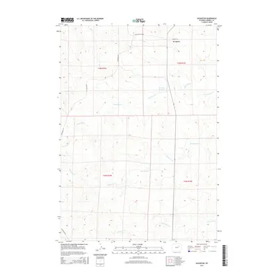
2015 Map of Savageton
USGS Topo · Published 2015About this map
Savageton is the focal point of this ranching-country survey in southern Campbell County. The community sits at the intersection of Savageton Rd and Black and Yellow Rd, surrounded by a landscape defined by seasonal drainages such as Mud Spring Cr and Greasewood Cr. The presence of the Schlautan Reservoir and various unnamed stock ponds reflects the essential infrastructure for livestock management in this high-plains environment. Northward, Nut Cr and westward Christensen Rd mark the bounds of the terrain, while the Public Land Survey System grid sections out the territory into township and range blocks like t45n r74w. This map captures the area as it appeared in the mid-2010s, showing the enduring rural character of the Wyoming rangeland before modern development significantly altered the drainage patterns of N Fourmile Cr.
Find a feature on this map
13 named features on this map. Tap any name to fly to it.
Don’t see what you’re looking for? This feature index may not catch every label — zoom into the map to look around manually.
Map Details
Editions of this 2015 Savageton Map
This is the sole edition of this map. No revisions or reprints were ever made.
Other maps of this area

1953 · Savageton
USGS Topo · 1:24,000

1953 · Fats Draw
USGS Topo · 1:24,000

1953 · South Butte
USGS Topo · 1:24,000

1953 · Rolling Pin Ranch
USGS Topo · 1:24,000

1953 · North Butte
USGS Topo · 1:24,000

1955 · Newcastle
USGS Topo · 1:250,000

1958 · Newcastle
USGS Topo · 1:250,000

1959 · Savageton
USGS Topo · 1:62,500

1959 · North Star School
USGS Topo · 1:62,500

1960 · Turnercrest
USGS Topo · 1:62,500