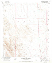
1971 Map of Savahia Peak SW
USGS Topo · Published 1973About this map
The Turtle Mountains dominate the western portion of this desert landscape, where the elevation drops sharply into the expansive Vidal Valley to the south. This 1971 survey captures a remote section of San Bernardino County defined by arid watercourses and sparse industrial activity. The prominent Gary Wash cuts across the northern terrain, leading toward several points of interest for historical researchers, including a Dry Well and a small Gravel Pit. To the east, the distinct elevation of Pyramid Butte rises above a network of unimproved tracks and a Jeep Trail. Evidence of small-scale mineral exploration is marked by a lone Prospect, reflecting the era's quiet but persistent prospecting activity in this reach of the California desert.
Find a feature on this map
8 named features on this map. Tap any name to fly to it.
Don’t see what you’re looking for? This feature index may not catch every label — zoom into the map to look around manually.
Map Details
Editions of this 1971 Savahia Peak SW Map
This is the sole edition of this map. No revisions or reprints were ever made.
Other maps of this area

1943 · Turtle Mts.
USGS Topo · 1:62,500

1943 · Vidal
USGS Topo · 1:62,500

1949 · Vidal
USGS Topo · 1:62,500

1950 · Vidal
USGS Topo · 1:62,500

1950 · Savahia Peak
USGS Topo · 1:62,500

1951 · Savahia Peak
USGS Topo · 1:62,500

1954 · Needles
USGS Topo · 1:250,000

1954 · Turtle Mountains
USGS Topo · 1:62,500

1954 · Rice
USGS Topo · 1:62,500

1956 · Needles
USGS Topo · 1:250,000