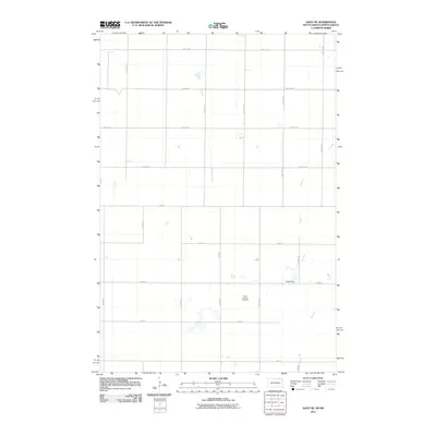
2011 Map of Savo NE
USGS Topo · Published 2011About this map
Peace Lutheran Cemetery stands as a central landmark in this rural landscape of Brown County, South Dakota, situated among the section lines of the Northern Plains. The map details a predominantly agricultural area defined by a strict grid of section-line roads, including 100th St SE and 397th Ave, which partition the prairie into a network of farms and fields. The hydrological character of the region is shaped by Dry Run, a seasonal drainage course that winds through the eastern portion of the township, south toward Engle Dam. Numerous small prairie potholes and ephemeral wetlands dot the terrain, reflecting the glaciated topography of the James River Valley. This survey documents the persistent rural infrastructure of the region, where the placement of small dams and localized water management features like those near 102nd St support the area's agricultural life.
Find a feature on this map
23 named features on this map. Tap any name to fly to it.
Don’t see what you’re looking for? This feature index may not catch every label — zoom into the map to look around manually.
Map Details
Editions of this 2011 Savo NE Map
This is the sole edition of this map. No revisions or reprints were ever made.
Other maps of this area

1894 · Hecla
USGS Topo · 1:62,500

1894 · Savo
USGS Topo · 1:62,500

1894 · Fullerton
USGS Topo · 1:62,500

1894 · Oakes
USGS Topo · 1:62,500

1895 · Lamoure
USGS Topo · 1:125,000

1896 · Columbia
USGS Topo · 1:125,000

1918 · La Moure
USGS Topo · 1:125,000

1953 · Jamestown
USGS Topo · 1:250,000

1953 · Savo SW
USGS Topo · 1:24,000

1953 · Houghton
USGS Topo · 1:24,000