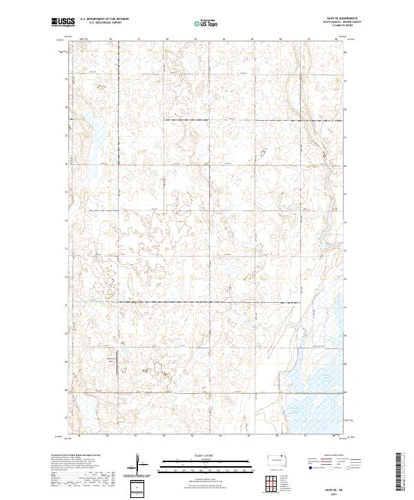
2021 Map of Savo SE
USGS Topo · Published 2021About this map
The Columbia Road Reservoir dominates the southeastern portion of this landscape in Brown County, where the James River valley meets the agricultural grid of the Dakota prairies. This 2021 survey illustrates a transition from the marshy, wetland-rich basins characteristic of the James River floodplain to the high-plains agriculture of northern South Dakota. The presence of the Auto Tour Rte and N Tour Rte suggests a managed landscape designed for public access and wildlife observation, centered around the reservoir's waters. Inland, the map detail focuses on the township and range system, punctuated by landmarks like Comstock Field and a dense network of section-line roads, including Co Rd 7 and Co Rd 16. The terrain is defined by subtle elevation changes and numerous depressions, reflecting the glacial history of the region and its contemporary use for waterfowl habitat and cereal farming.
Find a feature on this map
26 named features on this map. Tap any name to fly to it.
Don’t see what you’re looking for? This feature index may not catch every label — zoom into the map to look around manually.
Map Details
Editions of this 2021 Savo SE Map
This is the sole edition of this map. No revisions or reprints were ever made.
Other maps of this area

1894 · Hecla
USGS Topo · 1:62,500

1894 · Columbia
USGS Topo · 1:62,500

1894 · Savo
USGS Topo · 1:62,500

1896 · Columbia
USGS Topo · 1:125,000

1952 · Columbia NE
USGS Topo · 1:24,000

1952 · Westport
USGS Topo · 1:24,000

1953 · Savo SW
USGS Topo · 1:24,000

1953 · Houghton
USGS Topo · 1:24,000
1953 · Savo SE
USGS Topo · 1:24,000

1954 · Daly Corners
USGS Topo · 1:24,000
Featured Places
- Savo Township, SD
- Greenfield Township, SD
- Liberty Township, SD
- Shelby Township, SD
- Brainard Township, SD