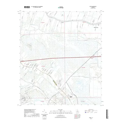
2018 Map of Savoie
USGS Topo · Published 2018About this map
Bayou Lafourche defines the upper portion of this coastal Louisiana landscape, where the communities of Raceland and Savoie occupy the narrow corridors of higher ground between the wetlands. The map illustrates a intricate network of water management and transportation that has shaped these parishes, from the Hollywood Canal and Bayou Cut Off to the many private lanes and plantation roads extending into the marshy interior. Local heritage is rooted in sites like Bell Baptist Church Cem, Third Zion Cem, and Saint Mary's Cem, which mark the community hubs along the bayou banks. The boundary between Lafourche Parish and Terrebonne Parish cuts diagonally across the sheet, separating Savoie from the expanding residential grid of Bayou Blue and Broadmoor.
Find a feature on this map
112 named features on this map. Tap any name to fly to it.
Don’t see what you’re looking for? This feature index may not catch every label — zoom into the map to look around manually.
Map Details
Editions of this 2018 Savoie Map
This is the sole edition of this map. No revisions or reprints were ever made.
Other maps of this area

1892 · Lac Des Allemands
USGS Topo · 1:62,500

1892 · Gibson
USGS Topo · 1:62,500

1892 · Houma
USGS Topo · 1:62,500

1892 · Thibodaux
USGS Topo · 1:62,500

1897 · Gibson
USGS Topo · 1:62,500

1932 · Houma SE
USGS Topo · 1:31,680

1932 · Lac Des Allemands SE
USGS Topo · 1:31,680

1932 · Lac Des Allemands SW
USGS Topo · 1:31,680

1932 · Houma SW
USGS Topo · 1:31,680

1932 · Houma NE
USGS Topo · 1:31,680