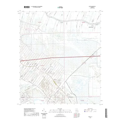
2020 Map of Savoie
USGS Topo · Published 2020About this map
Bayou Lafourche defines the northern reaches of this coastal landscape, where the town of Raceland sits at the junction of historic waterways and modern transit corridors. This area demonstrates the unique "long-lot" ribbon development characteristic of South Louisiana, where property lines extend away from the bayou banks into the wetlands. In the southern portion, the communities of Savoie, Broadmoor, and Bayou Blue follow the higher ground along the ridges. For genealogists, several significant burial grounds are documented, including the Saint Louis Catholic Cem and Bell Baptist Church Cem. The map traces the intricate drainage network of the marshes, from Bayou Grand Coteau to Saint Louis Bayou, illustrating the complex relationship between land use and the water in Lafourche and Terrebonne Parishes.
Find a feature on this map
113 named features on this map. Tap any name to fly to it.
Don’t see what you’re looking for? This feature index may not catch every label — zoom into the map to look around manually.
Map Details
Editions of this 2020 Savoie Map
This is the sole edition of this map. No revisions or reprints were ever made.
Other maps of this area

1892 · Lac Des Allemands
USGS Topo · 1:62,500

1892 · Gibson
USGS Topo · 1:62,500

1892 · Houma
USGS Topo · 1:62,500

1892 · Thibodaux
USGS Topo · 1:62,500

1897 · Gibson
USGS Topo · 1:62,500

1932 · Houma SE
USGS Topo · 1:31,680

1932 · Lac Des Allemands SE
USGS Topo · 1:31,680

1932 · Lac Des Allemands SW
USGS Topo · 1:31,680

1932 · Houma SW
USGS Topo · 1:31,680

1932 · Houma NE
USGS Topo · 1:31,680