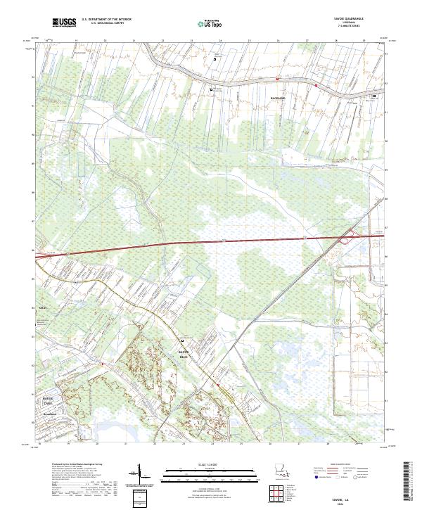
2024 Map of Savoie
USGS Topo · Published 2024About this map
Bayou Lafourche winds along the northern edge of this map, defining the historic settlement pattern of Raceland and its surrounding agricultural fields. The landscape is a complex network of wetlands and waterways, where natural distributaries like Bayou Blue and Bayou Grand Coteau intersect with engineered features like the Hollywood Canal. This transition from the natural bayou system to organized drainage is evident in the alignment of roads such as Ariel Plantation Rd and Raceland Stockyards Rd. For genealogists and local historians, the map is a dense record of community landmarks, including the Saint Louis Catholic Cem and Saint Mary's Cem. From the residential neighborhoods of Broadmoor and Bayou Cane to the open expanses of Theriot Field, this survey captures the evolving border between Lafourche Parish and Terrebonne Parish.
Find a feature on this map
179 named features on this map. Tap any name to fly to it.
Don’t see what you’re looking for? This feature index may not catch every label — zoom into the map to look around manually.
Map Details
Editions of this 2024 Savoie Map
This is the sole edition of this map. No revisions or reprints were ever made.
Other maps of this area

1892 · Lac Des Allemands
USGS Topo · 1:62,500

1892 · Gibson
USGS Topo · 1:62,500

1892 · Houma
USGS Topo · 1:62,500

1892 · Thibodaux
USGS Topo · 1:62,500

1897 · Gibson
USGS Topo · 1:62,500

1932 · Houma SE
USGS Topo · 1:31,680

1932 · Lac Des Allemands SE
USGS Topo · 1:31,680

1932 · Lac Des Allemands SW
USGS Topo · 1:31,680

1932 · Houma SW
USGS Topo · 1:31,680

1932 · Houma NE
USGS Topo · 1:31,680