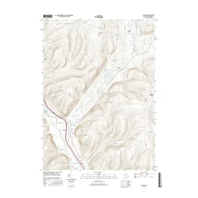
2016 Map of Savona
USGS Topo · Published 2016About this map
The Cohocton River valley serves as the primary corridor for settlement and transit in this Steuben County landscape, with the village of Savona situated near its confluence with Mud Creek. The terrain is defined by a series of prominent uplands, including Irish Hill, Oak Hill, and Brown Hill, which separate the river valley from the clustered lake systems to the north. These smaller water bodies, such as Sanford Lake, Van Keuren Lake, and Peterson Lake, create a distinct pocket of geography near Sonora.
Find a feature on this map
82 named features on this map. Tap any name to fly to it.
Don’t see what you’re looking for? This feature index may not catch every label — zoom into the map to look around manually.
Map Details
Editions of this 2016 Savona Map
This is the sole edition of this map. No revisions or reprints were ever made.
Other maps of this area

1903 · Hammondsport
USGS Topo · 1:62,500

1910 · Bath
USGS Topo · 1:62,500

1914 · Corning
USGS Topo · 1:62,500

1924 · Woodhull
USGS Topo · 1:48,000

1926 · Woodhull
USGS Topo · 1:62,500

1944 · Woodhull
USGS Topo · 1:62,500

1944 · Corning
USGS Topo · 1:62,500

1950 · Elmira
USGS Topo · 1:250,000
1953 · Wayne
USGS Topo · 1:24,000

1953 · Campbell
USGS Topo · 1:24,000