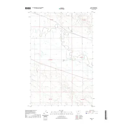
2020 Map of Savoy
USGS Topo · Published 2020About this map
Savoy is situated along the northern banks of the meandering Milk River in this part of Blaine County. The landscape is defined by the complex hydrology of the river valley, where natural features like Old Thunder Slough exist alongside an engineered network of waterways including Main Canal A, Main Canal B, and N Canal. These irrigation structures reflect the agricultural development required to manage the water in this semi-arid region. To the south, the terrain rises away from the river into a series of drainages such as White Bear Cr, Bear Cr, and Spring Cr. Near the center of the sheet, the Fort Belknap Cem stands as a significant point of local history and genealogy. The local road network, including Old Savoy Rd and River Rd, follows the natural contours of the valley, connecting the small settlement of Savoy to the surrounding ranching and farming lands.
Find a feature on this map
28 named features on this map. Tap any name to fly to it.
Don’t see what you’re looking for? This feature index may not catch every label — zoom into the map to look around manually.
Map Details
Editions of this 2020 Savoy Map
This is the sole edition of this map. No revisions or reprints were ever made.
Other maps of this area

1903 · Wayne Creek
USGS Topo · 1:62,500

1905 · Wayne Creek
USGS Topo · 1:62,500

1913 · Cherry Ridge
USGS Topo · 1:125,000

1920 · Avery
USGS Topo · 1:125,000

1953 · Havre
USGS Topo · 1:250,000

1957 · Havre
USGS Topo · 1:250,000

1958 · Havre
USGS Topo · 1:250,000

1964 · Threemile Reservoir
USGS Topo · 1:24,000

1964 · Wayne Creek SE
USGS Topo · 1:24,000

1964 · Coburg
USGS Topo · 1:24,000