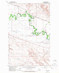
1964 Map of Savoy
USGS Topo · Published 1967About this map
The Milk River snakes through the northern Montana landscape, defining the northern limit of the Fort Belknap Indian Reservation Boundary. This 1964 survey captures a rural landscape where the Great Northern railroad and a network of irrigation channels like the North Main Canal and the Main Canal dominate the valley floor. The small settlement of Savoy sits along the rail line, serving as a focal point for the surrounding ranching and farming operations.
Find a feature on this map
16 named features on this map. Tap any name to fly to it.
Don’t see what you’re looking for? This feature index may not catch every label — zoom into the map to look around manually.
Map Details
Editions of this 1964 Savoy Map
This is the sole edition of this map. No revisions or reprints were ever made.
Other maps of this area

1903 · Wayne Creek
USGS Topo · 1:62,500

1905 · Wayne Creek
USGS Topo · 1:62,500

1913 · Cherry Ridge
USGS Topo · 1:125,000

1920 · Avery
USGS Topo · 1:125,000

1953 · Havre
USGS Topo · 1:250,000

1957 · Havre
USGS Topo · 1:250,000

1958 · Havre
USGS Topo · 1:250,000

1964 · Threemile Reservoir
USGS Topo · 1:24,000

1964 · Wayne Creek SE
USGS Topo · 1:24,000

1964 · Coburg
USGS Topo · 1:24,000