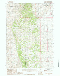
1984 Map of Sawmill Canyon
USGS Topo · Published 1984About this map
Pine Ridge dominates the landscape of this high plains region where the borders of Johnson, Natrona, Campbell, and Converse counties converge. The drainage patterns of the North Fork Powder R are clearly visible, with numerous named draws and canyons cutting through the elevated terrain. Local navigation and livestock management in the late twentieth century relied on these deep drainages, such as Sawmill Canyon, Schooner Canyon, and the curiously named Dead Dog Draw. The network of watercourses, including Meadow Creek and Wind Creek, illustrates the complex erosion of the ridge system. This provisional data highlights the isolation of the area, defined primarily by its physical geography and the administrative boundaries that meet in these sparsely populated ranching lands.
Find a feature on this map
21 named features on this map. Tap any name to fly to it.
Don’t see what you’re looking for? This feature index may not catch every label — zoom into the map to look around manually.
Map Details
Editions of this 1984 Sawmill Canyon Map
This is the sole edition of this map. No revisions or reprints were ever made.
Other maps of this area

1954 · Artesian Draw
USGS Topo · 1:24,000

1954 · Linch
USGS Topo · 1:24,000

1954 · Taylor Ranch
USGS Topo · 1:24,000

1955 · Newcastle
USGS Topo · 1:250,000

1955 · Arminto
USGS Topo · 1:250,000

1958 · Arminto
USGS Topo · 1:250,000

1958 · Newcastle
USGS Topo · 1:250,000

1959 · Edgerton
USGS Topo · 1:62,500

1960 · Ross
USGS Topo · 1:62,500

1962 · Arminto
USGS Topo · 1:250,000