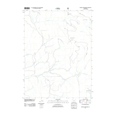
2011 Map of Sawmill Mountain
USGS Topo · Published 2011About this map
Coal Creek Number One Mine sits in the northern reaches of this Colorado landscape, highlighting the industrial history of Rio Blanco County. The terrain is defined by the prominent Sawmill Mountain and the high elevations of Hay Park, where a network of watercourses including Sawmill Creek and Cottonwood Creek drain the slopes. The agricultural infrastructure of the region is evident in the south, anchored by the Big Lick Irrigation Dam and Big Lick Reservoir, which manage water flow through the Big Licks area. A web of county roads, such as County Rd 40 and County Rd 49, connects these remote industrial and ranching sites, following the natural contours provided by Little Beaver Creek and Dickerville Creek. The presence of the Coal Creek Feeder Ditch further illustrates the complex water management systems required to support activity in this high-country environment.
Find a feature on this map
27 named features on this map. Tap any name to fly to it.
Don’t see what you’re looking for? This feature index may not catch every label — zoom into the map to look around manually.
Map Details
Editions of this 2011 Sawmill Mountain Map
This is the sole edition of this map. No revisions or reprints were ever made.
Other maps of this area

1906 · Grand Hogback
USGS Topo · 1:125,000

1910 · Danforth Hills
USGS Topo · 1:125,000

1910 · Grand Hogback
USGS Topo · 1:125,000

1912 · Meeker
USGS Topo · 1:62,500

1914 · Meeker
USGS Topo · 1:62,500

1954 · Craig
USGS Topo · 1:250,000

1957 · Craig
USGS Topo · 1:250,000

1957 · Leadville
USGS Topo · 1:250,000

1958 · Craig
USGS Topo · 1:250,000

1959 · Leadville
USGS Topo · 1:250,000