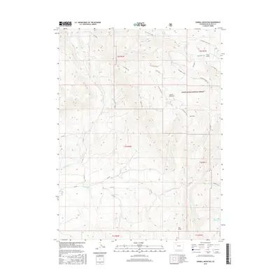
2016 Map of Sawmill Mountain
USGS Topo · Published 2016About this map
Sawmill Mountain stands as the central landmark of this high-elevation landscape within the White River National Forest. The 2016 survey illustrates a complex network of resource management and recreational access, featuring numerous county roads and established paths like the S Coal Ridge Trail and Stove Ridge Trail. The drainage patterns are defined by the headwaters of several creeks, including Little Beaver Cr and Cherry Cr, alongside man-made water management features such as the Coal Cr Feeder Ditch.
Find a feature on this map
42 named features on this map. Tap any name to fly to it.
Don’t see what you’re looking for? This feature index may not catch every label — zoom into the map to look around manually.
Map Details
Editions of this 2016 Sawmill Mountain Map
This is the sole edition of this map. No revisions or reprints were ever made.
Other maps of this area

1906 · Grand Hogback
USGS Topo · 1:125,000

1910 · Danforth Hills
USGS Topo · 1:125,000

1910 · Grand Hogback
USGS Topo · 1:125,000

1912 · Meeker
USGS Topo · 1:62,500

1914 · Meeker
USGS Topo · 1:62,500

1954 · Craig
USGS Topo · 1:250,000

1957 · Craig
USGS Topo · 1:250,000

1957 · Leadville
USGS Topo · 1:250,000

1958 · Craig
USGS Topo · 1:250,000

1959 · Leadville
USGS Topo · 1:250,000