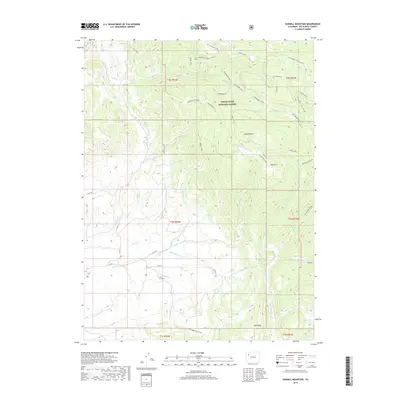
2019 Map of Sawmill Mountain
USGS Topo · Published 2019About this map
White River National Forest lands dominate this part of Rio Blanco County, characterized by a network of drainage systems including Little Beaver Creek and the eponymous Sawmill Creek. The map documents a transition in land use and topography, from the high points of Sawmill Mountain and Dickerville Ridge down to the watering hole of Big Lick Reservoir. Evidence of industrial history is visible in the north with the Coal/Uranium Cutoff, while recreation and traditional access are preserved via the Columbine Trail and the Oak Ridge horse trail. The presence of Columbine Station and Hay Park suggests early forest management and grazing hubs within this high-altitude landscape.
Find a feature on this map
44 named features on this map. Tap any name to fly to it.
Don’t see what you’re looking for? This feature index may not catch every label — zoom into the map to look around manually.
Map Details
Editions of this 2019 Sawmill Mountain Map
This is the sole edition of this map. No revisions or reprints were ever made.
Other maps of this area

1906 · Grand Hogback
USGS Topo · 1:125,000

1910 · Danforth Hills
USGS Topo · 1:125,000

1910 · Grand Hogback
USGS Topo · 1:125,000

1912 · Meeker
USGS Topo · 1:62,500

1914 · Meeker
USGS Topo · 1:62,500

1954 · Craig
USGS Topo · 1:250,000

1957 · Craig
USGS Topo · 1:250,000

1957 · Leadville
USGS Topo · 1:250,000

1958 · Craig
USGS Topo · 1:250,000

1959 · Leadville
USGS Topo · 1:250,000