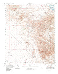
1950 Map of Sawtooth Range
USGS Topo · Published 1985About this map
The Sawtooth Range and the Chemehuevi Mountains dominate this 1950 survey of the California-Arizona borderlands. Centered on the arid expanse of the Chemehuevi Valley, the map details a landscape defined by dramatic geological formations and the essential flow of the Colorado River. Along the eastern margin, the Havasu Lake reservoir is visible within the Havasu National Wildlife Refuge, marking the managed river system of the mid-century. Significant landmarks for desert navigation include the jagged peaks of Snaggletooth and Whale Mtn, alongside the high point of Chemehuevi Peak. Sparse human activity is recorded through scattered mines and prospects, while the Old National Trails Road traces a historic path through the Sacramento Mountains, illustrating the early 20th-century transportation network before modern interstate expansion.
Find a feature on this map
18 named features on this map. Tap any name to fly to it.
Don’t see what you’re looking for? This feature index may not catch every label — zoom into the map to look around manually.
Map Details
Editions of this 1950 Sawtooth Range Map
3 editions found
Other maps of this area

1903 · Needles
USGS Topo · 1:125,000

1904 · Needles Special
USGS Topo · 1:125,000

1911 · Parker
USGS Topo · 1:125,000

1943 · Center Hills
USGS Topo · 1:62,500

1943 · Topock
USGS Topo · 1:62,500

1943 · Whipple Mts.
USGS Topo · 1:62,500

1943 · Bannock
USGS Topo · 1:62,500

1943 · Turtle Mts.
USGS Topo · 1:62,500

1950 · Topock
USGS Topo · 1:62,500

1950 · Sawtooth Range
USGS Topo · 1:62,500