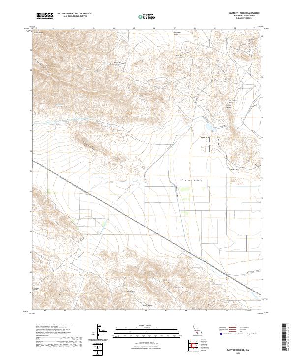
2021 Map of Sawtooth Ridge
USGS Topo · Published 2021About this map
Sawtooth Ridge and the Diablo Range define the western reaches of this section of the Central Valley, where the high desert terrain meets complex water infrastructure. The landscape is marked by the massive engineering of the California Aqueduct and the Governor Edmund G Brown Coastal-Br-California Aqueduct, which cut across the arid hills. To the east, the Pyramid Hills and Shale Hills rise above the San Joaquin Valley floor, while Devils Den sits at the northern edge of Antelope Valley. This region is a study in agricultural water management, evidenced by the Berrenda Canal and Berrenda-Mesa Canal. Local landmarks like Raven Pass and the Hilbrich Grade suggest the historic difficulty of traversing these ranges before modern roads like Rte 46 were established.
Find a feature on this map
32 named features on this map. Tap any name to fly to it.
Don’t see what you’re looking for? This feature index may not catch every label — zoom into the map to look around manually.
Map Details
Editions of this 2021 Sawtooth Ridge Map
This is the sole edition of this map. No revisions or reprints were ever made.
Other maps of this area

1914 · Lost Hills
USGS Topo · 1:125,000

1914 · Cholame
USGS Topo · 1:125,000

1915 · Cholame
USGS Topo · 1:125,000

1917 · Cholame
USGS Topo · 1:125,000

1930 · Avenal Gap
USGS Topo · 1:31,680

1933 · Avenal Gap
USGS Topo · 1:31,680

1942 · Tent Hills
USGS Topo · 1:24,000

1943 · Packwood
USGS Topo · 1:31,680

1943 · Grant Lake
USGS Topo · 1:31,680
1943 · Tent Hills
USGS Topo · 1:31,680