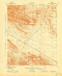
1943 Map of Sawtooth Ridge
USGS Topo · Published 1943About this map
Kecks Corners serves as a lone commercial focal point in this 1943 survey, marking the intersection where State Route 33 and State Route 41 meet. The landscape is dominated by the dramatic uplift of the Temblor Range and the Sawtooth Ridge, which separate the broad expanse of Antelope Valley from the more secluded Barrel Valley. This wartime-era map, prepared under the direction of the Corps of Engineers, details a high-desert environment where water sources like Aido Spring and the ephemeral San Francisco Creek were vital for local travel and livestock.
Find a feature on this map
19 named features on this map. Tap any name to fly to it.
Don’t see what you’re looking for? This feature index may not catch every label — zoom into the map to look around manually.
Map Details
Editions of this 1943 Sawtooth Ridge Map
This is the sole edition of this map. No revisions or reprints were ever made.
Other maps of this area

1914 · Lost Hills
USGS Topo · 1:125,000

1914 · Cholame
USGS Topo · 1:125,000

1915 · Cholame
USGS Topo · 1:125,000

1917 · Cholame
USGS Topo · 1:125,000

1930 · Avenal Gap
USGS Topo · 1:31,680

1933 · Avenal Gap
USGS Topo · 1:31,680

1942 · Tent Hills
USGS Topo · 1:24,000

1943 · Packwood
USGS Topo · 1:31,680

1943 · Grant Lake
USGS Topo · 1:31,680
1943 · Tent Hills
USGS Topo · 1:31,680