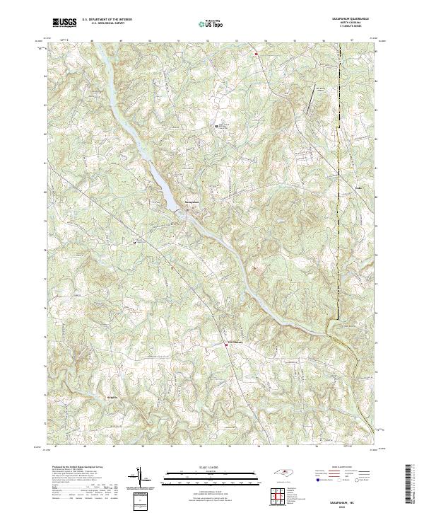
2022 Map of Saxapahaw
USGS Topo · Published 2022About this map
The Haw River winds through the heart of this Alamance County landscape, carving a path between the settlements of Saxapahaw and Eli Whitney. The terrain is defined by a dense network of tributaries including Cane Creek, Meadow Cr, and Marys Cr, which dictate the winding paths of rural routes like Phillips Chapel Rd and Mebane Oaks Rd. This 2022 survey captures the area's transition from traditional agricultural roots to contemporary rural residential life, evidenced by the presence of The Duchy Airport and modern developments near the Orange County line.
Find a feature on this map
117 named features on this map. Tap any name to fly to it.
Don’t see what you’re looking for? This feature index may not catch every label — zoom into the map to look around manually.
Map Details
Editions of this 2022 Saxapahaw Map
This is the sole edition of this map. No revisions or reprints were ever made.
Other maps of this area

1953 · Raleigh
USGS Topo · 1:250,000

1953 · Greensboro
USGS Topo · 1:250,000

1954 · Greensboro
USGS Topo · 1:250,000

1954 · Raleigh
USGS Topo · 1:250,000

1962 · Greensboro
USGS Topo · 1:250,000

1966 · Greensboro
USGS Topo · 1:250,000

1968 · White Cross
USGS Topo · 1:24,000

1968 · Efland
USGS Topo · 1:24,000

1968 · Bynum
USGS Topo · 1:24,000

1969 · Burlington
USGS Topo · 1:24,000