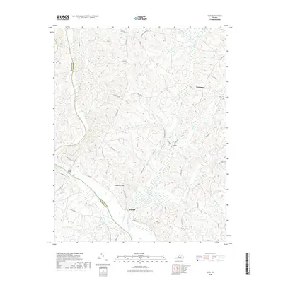
2019 Map of Saxe
USGS Topo · Published 2019About this map
Mulberry Hill and Randolph sit along the northern banks of the Roanoke River, where the waterway serves as the natural boundary between Charlotte and Halifax Counties. This Piedmont landscape is defined by its intricate drainage network, with Roanoke Creek, Wards Fork Cr, and Twittys Cr carving through the terrain to join the main river valley. Small rural settlements like Saxe, Mossingford, and Formosa are connected by a web of named secondary roads such as Brick House Rd and Scuffletown Rd, reflecting the area's deep-rooted agricultural and rural layout. Researchers can trace land patterns along Black Walnut Cr or follow the Fort Hill Trl near the river's edge, highlighting the historical transition from river-based transport to established inland crossroads communities.
Find a feature on this map
64 named features on this map. Tap any name to fly to it.
Don’t see what you’re looking for? This feature index may not catch every label — zoom into the map to look around manually.
Map Details
Editions of this 2019 Saxe Map
This is the sole edition of this map. No revisions or reprints were ever made.
Other maps of this area

1892 · Appomattox
USGS Topo · 1:125,000

1947 · Roanoke
USGS Topo · 1:250,000

1953 · Greensboro
USGS Topo · 1:250,000

1954 · Greensboro
USGS Topo · 1:250,000

1954 · Clover
USGS Topo · 1:62,500

1954 · Halifax
USGS Topo · 1:62,500

1956 · Brookneal
USGS Topo · 1:62,500

1956 · Charlotte Court House
USGS Topo · 1:62,500

1959 · Roanoke
USGS Topo · 1:250,000

1962 · Greensboro
USGS Topo · 1:250,000