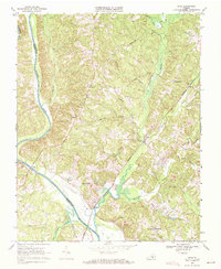
1968 Map of Saxe
USGS Topo · Published 1972About this map
Saxe and Randolph anchor this southern Virginia landscape during a period of transition for the local waterways. The southern portion of the map is dominated by the widening reach of the John H Kerr Reservoir, where the Roanoke River begins to swell toward the dam downstream. This hydrologic shift contrasts with the upland topography where small rural communities like Formosa and Mossingford remain connected by the Southern railroad line. The map captures a high density of rural religious life, documented through numerous local landmarks such as New Hope Ch, Galilee Ch, and Hermon Ch. The drainage patterns of Twittys Creek, Roanoke Creek, and Wards Fork Creek illustrate the dissected terrain that characterized Charlotte County and Halifax County before significant modern development altered the woodland and agricultural footprint.
Find a feature on this map
35 named features on this map. Tap any name to fly to it.
Don’t see what you’re looking for? This feature index may not catch every label — zoom into the map to look around manually.
Map Details
Editions of this 1968 Saxe Map
This is the sole edition of this map. No revisions or reprints were ever made.
Other maps of this area

1892 · Appomattox
USGS Topo · 1:125,000

1947 · Roanoke
USGS Topo · 1:250,000

1953 · Greensboro
USGS Topo · 1:250,000

1954 · Greensboro
USGS Topo · 1:250,000

1954 · Clover
USGS Topo · 1:62,500

1954 · Halifax
USGS Topo · 1:62,500

1956 · Brookneal
USGS Topo · 1:62,500

1956 · Charlotte Court House
USGS Topo · 1:62,500

1959 · Roanoke
USGS Topo · 1:250,000

1962 · Greensboro
USGS Topo · 1:250,000