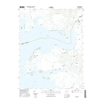
2016 Map of Saxis
USGS Topo · Published 2016About this map
Saxis Island and the neighboring shoreline of Accomack Co, Virginia, define this coastal landscape at the edge of Pocomoke Sound. The map reveals a high-density network of marshlands and narrow waterways, including Mantrap Gut, Robin Hood Bay, and the expansive The Muds. The settlement of Saxis is clustered on the western shore, where the Baptist Churchyard Cem serves as a significant genealogical marker for the island community. Inland, the landscape transitions to small agricultural and residential hubs such as Sanford, Grotons, and Messongo. The state border between Virginia and Maryland follows the course of the Pocomoke River near Shelltown, illustrating the complex water-based boundaries of the Delmarva Peninsula. This survey captures a moment where local life is intricately tied to the surrounding marsh environments, from Michael Marsh to the timbered reaches near Poulson.
Find a feature on this map
82 named features on this map. Tap any name to fly to it.
Don’t see what you’re looking for? This feature index may not catch every label — zoom into the map to look around manually.
Map Details
Editions of this 2016 Saxis Map
This is the sole edition of this map. No revisions or reprints were ever made.
Other maps of this area

1903 · Crisfield
USGS Topo · 1:62,500

1903 · Deal Island
USGS Topo · 1:62,500

1920 · Crisfield
USGS Topo · 1:62,500

1942 · Chesconessex
USGS Topo · 1:31,680

1942 · Marion
USGS Topo · 1:24,000

1942 · Kingston
USGS Topo · 1:24,000

1942 · Mappsville
USGS Topo · 1:24,000

1942 · Saxis
USGS Topo · 1:24,000

1942 · Parksley
USGS Topo · 1:24,000

1943 · Parksley
USGS Topo · 1:31,680