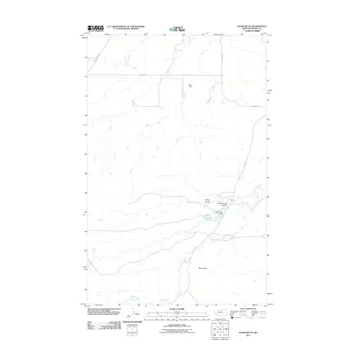
2011 Map of Sayer Butte
USGS Topo · Published 2011About this map
Sayer Butte rises above the drainage networks of Blaine County, serving as a prominent landmark in this segment of the northern Montana plains. The landscape is defined by the winding course of Bean Creek and the managed waters of Grasshopper Reservoir, which is held by the Grasshopper Dam. This 2011 survey illustrates a region where local infrastructure, such as Staff Rd and Lloyd Rd, connects the scattered elements of rural industry and land management.
Find a feature on this map
12 named features on this map. Tap any name to fly to it.
Don’t see what you’re looking for? This feature index may not catch every label — zoom into the map to look around manually.
Map Details
Editions of this 2011 Sayer Butte Map
This is the sole edition of this map. No revisions or reprints were ever made.
Other maps of this area

1904 · Yantic
USGS Topo · 1:62,500

1904 · Chinook
USGS Topo · 1:62,500

1912 · Zurich
USGS Topo · 1:125,000

1953 · Havre
USGS Topo · 1:250,000

1956 · Lloyd
USGS Topo · 1:62,500

1956 · Cleveland
USGS Topo · 1:62,500

1957 · Havre
USGS Topo · 1:250,000

1958 · Havre
USGS Topo · 1:250,000
1964 · Lohman SE
USGS Topo · 1:24,000
1964 · Lohman
USGS Topo · 1:24,000