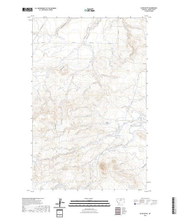
2024 Map of Sayer Butte
USGS Topo · Published 2024About this map
Tiger Ridge and the volcanic prominence of Sayer Butte define this high-plains landscape in Blaine County, Montana. The terrain is deeply incised by a series of drainages, primarily Threemile Creek and Bean Creek, which carry seasonal runoff toward larger systems. The presence of Grasshopper Reservoir in the eastern portion of the quadrangle suggests the importance of water management in this arid ranching country. Transportation is maintained through a network of rural routes, including the prominent Stage Rd and Lloyd Rd, which follow the natural contours of the coulees. The map illustrates a typical northern Montana topography where named features like Bailey Coulee and Black Coulee serve as critical landmarks for navigating the expansive open range.
Find a feature on this map
22 named features on this map. Tap any name to fly to it.
Don’t see what you’re looking for? This feature index may not catch every label — zoom into the map to look around manually.
Map Details
Editions of this 2024 Sayer Butte Map
This is the sole edition of this map. No revisions or reprints were ever made.
Other maps of this area

1904 · Yantic
USGS Topo · 1:62,500

1904 · Chinook
USGS Topo · 1:62,500

1912 · Zurich
USGS Topo · 1:125,000

1953 · Havre
USGS Topo · 1:250,000

1956 · Lloyd
USGS Topo · 1:62,500

1956 · Cleveland
USGS Topo · 1:62,500

1957 · Havre
USGS Topo · 1:250,000

1958 · Havre
USGS Topo · 1:250,000
1964 · Lohman SE
USGS Topo · 1:24,000
1964 · Lohman
USGS Topo · 1:24,000