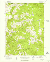
1954 Map of Scandia
USGS Topo · Published 1956About this map
Warren State Hospital occupies a prominent position in the southwest corner of this mid-1950s survey of the northern Pennsylvania border. The landscape is defined by the high divides of Quaker Ridge and Elk Ridge, which separate a network of steep drainages such as Akeley Run and Hodge Run. Scattered agricultural and residential crossroads dot the high ground, including Scandia and several named intersections like Lounsbury Corners and Macks Corners. Local history and genealogy are well-represented by distinctive landmarks like the Seven Dolors Cem and the remote Gouldtown settlement near the Stateline. The presence of numerous Gas Wells throughout the southern valleys, particularly near Smith Corners, points to the region's enduring connection to the Pennsylvania oil and gas industry, while place names like Goose Heaven Hill and Gardners Rocks suggest a landscape used for hunting and timbering.
Find a feature on this map
49 named features on this map. Tap any name to fly to it.
Don’t see what you’re looking for? This feature index may not catch every label — zoom into the map to look around manually.
Map Details
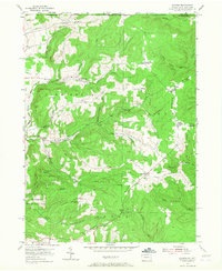
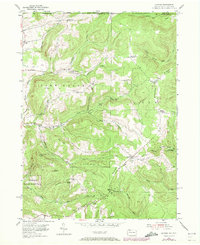
Editions of this 1954 Scandia Map
3 editions found
Other maps of this area

1905 · Jamestown
USGS Topo · 1:62,500

1906 · Warren
USGS Topo · 1:62,500

1907 · Warren
USGS Topo · 1:62,500

1908 · Warren
USGS Topo · 1:62,500

1922 · Randolph
USGS Topo · 1:62,500

1923 · Randolph
USGS Topo · 1:62,500

1936 · Kinzua
USGS Topo · 1:48,000

1941 · Kinzua
USGS Topo · 1:62,500

1942 · Jamestown
USGS Topo · 1:62,500

1943 · Randolph
USGS Topo · 1:62,500