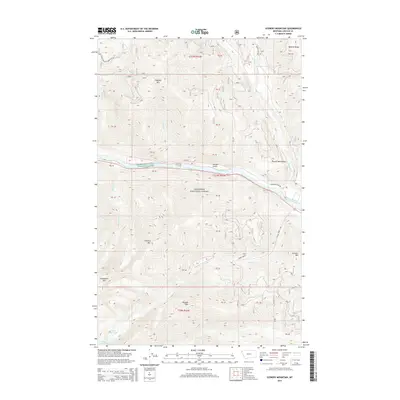
2014 Map of Scenery Mountain
USGS Topo · Published 2014About this map
The Kootenai River carves a deep valley through the northern Purcell Mountains, serving as the central corridor for this part of the Kootenai National Forest. In this 2014 survey, the primary transport artery follows the northern bank along the Kootenai River Rd, while the surrounding terrain is defined by prominent peaks including Scenery Mtn, Flagstaff Mtn, and Grambauer Mtn. The hydrology of the area is particularly complex, with numerous drainages like Quartz Cr and Cedar Cr feeding into the main river channel. High-altitude water bodies such as Lower Cedar Lake and Upper Cedar Lake sit tucked below the ridges, providing a detailed look at the montane watershed system. This map illustrates the intersection of industrial forest management and the preservation of the landscape, marked by various land tracts such as PB 44 and PB 46.
Find a feature on this map
37 named features on this map. Tap any name to fly to it.
Don’t see what you’re looking for? This feature index may not catch every label — zoom into the map to look around manually.
Map Details
Editions of this 2014 Scenery Mountain Map
This is the sole edition of this map. No revisions or reprints were ever made.
Other maps of this area

1920 · Libby
USGS Topo · 1:125,000

1930 · Libby
USGS Topo · 1:125,000

1932 · Libby
USGS Topo · 1:125,000

1957 · Kalispell
USGS Topo · 1:250,000

1960 · Kalispell
USGS Topo · 1:250,000

1961 · Kalispell
USGS Topo · 1:250,000

1963 · Scenery Mountain
USGS Topo · 1:24,000

1963 · Turner Mountain
USGS Topo · 1:24,000

1963 · Pulpit Mountain
USGS Topo · 1:24,000

1963 · Treasure Mountain
USGS Topo · 1:24,000