
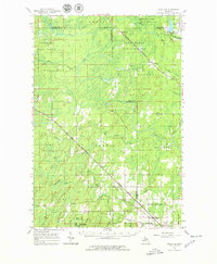
1963 Map of Schaffer
USGS Topo · Published 1965About this map
The Escanaba River and Ford River systems dominate this landscape in Michigan's Upper Peninsula, carving through the Escanaba River State Forest and Menominee State Forest. The early 1960s terrain is marked by a network of timber-related infrastructure and small settlements like Schaffer, Perronville, and Hendricks. Transportation follows a clear industrial logic, with the Chicago and North Western and Soo Line railroads cutting diagonal paths through the forests to serve the regional economy.
Find a feature on this map
52 named features on this map. Tap any name to fly to it.
Don’t see what you’re looking for? This feature index may not catch every label — zoom into the map to look around manually.
Map Details
Editions of this 1963 Schaffer Map
2 editions found
Other maps of this area

1932 · Rock SW
USGS Topo · 1:31,680

1932 · Bark River NE
USGS Topo · 1:31,680

1932 · Whitney NE
USGS Topo · 1:31,680

1932 · Whitney SE
USGS Topo · 1:31,680

1932 · Helena SW
USGS Topo · 1:31,680

1932 · Gladstone SW
USGS Topo · 1:31,680

1932 · Helena
USGS Topo · 1:31,680

1932 · Gladstone NW
USGS Topo · 1:31,680

1950 · Gladstone NW
USGS Topo · 1:31,680

1951 · Helena SW
USGS Topo · 1:31,680