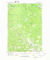
1963 Map of Schaffer
USGS Topo · Published 1978About this map
Escanaba River State Forest and Menominee State Forest dominate this Upper Peninsula landscape, where industrial logging and transport patterns are clearly visible in the early 1960s. The Chicago and North Western Line cuts a diagonal path through the timberland, connecting small rail-side settlements like Perronville, Whitney, and La Branche. These communities, alongside smaller stops such as Eustis and Teseh, represent the rail-dependent economy of the era. The hydro-electric potential of the region is evident at the Boney Falls Basin on the Escanaba River, while the southern reaches of the map show agricultural and social centers such as Schaffer and the Bark River Cem. The network of creeks, including Tenmile Creek and Whitney Creek, underscores the complex drainage of this forest-heavy terrain within Menominee Co and Delta Co.
Find a feature on this map
48 named features on this map. Tap any name to fly to it.
Don’t see what you’re looking for? This feature index may not catch every label — zoom into the map to look around manually.
Map Details
Editions of this 1963 Schaffer Map
2 editions found

Other maps of this area

1932 · Rock SW
USGS Topo · 1:31,680

1932 · Bark River NE
USGS Topo · 1:31,680

1932 · Whitney NE
USGS Topo · 1:31,680

1932 · Whitney SE
USGS Topo · 1:31,680

1932 · Helena SW
USGS Topo · 1:31,680

1932 · Gladstone SW
USGS Topo · 1:31,680

1932 · Helena
USGS Topo · 1:31,680

1932 · Gladstone NW
USGS Topo · 1:31,680

1950 · Gladstone NW
USGS Topo · 1:31,680

1951 · Helena SW
USGS Topo · 1:31,680