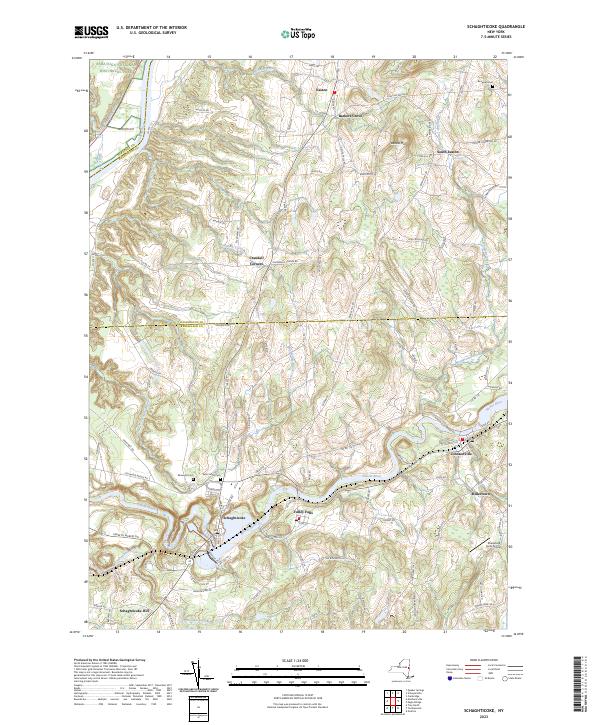
2023 Map of Schaghticoke
USGS Topo · Published 2023About this map
Schaghticoke and Valley Falls anchor this portion of the Hoosic River valley, where the water's path cuts through the borderlands of Rensselaer, Washington, and Saratoga counties. The landscape is defined by the legacy of early industry and transport, evidenced by the trace of the Old Champlain Canal near the Hudson River and the rural crossroads of Easton and Johnsonville. Genealogical interest is concentrated in several burial grounds, including Saint Johns Cem and Elmwood Cem, which serve as quiet landmarks for the area's long-established families.
Find a feature on this map
110 named features on this map. Tap any name to fly to it.
Don’t see what you’re looking for? This feature index may not catch every label — zoom into the map to look around manually.
Map Details
Editions of this 2023 Schaghticoke Map
This is the sole edition of this map. No revisions or reprints were ever made.
Other maps of this area

1893 · Cohoes
USGS Topo · 1:62,500

1895 · Cohoes
USGS Topo · 1:62,500

1895 · Cambridge
USGS Topo · 1:62,500

1897 · Hoosick
USGS Topo · 1:62,500

1898 · Cambridge
USGS Topo · 1:62,500

1898 · Cohoes
USGS Topo · 1:62,500

1900 · Taconic
USGS Topo · 1:125,000

1900 · Schuylerville
USGS Topo · 1:62,500

1901 · Cambridge
USGS Topo · 1:62,500

1903 · Mettawee
USGS Topo · 1:125,000