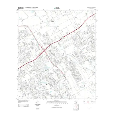
2013 Map of Schertz
USGS Topo · Published 2013About this map
Randolph Air Force Base dominates the southeastern portion of this map, featuring the structured layout of the Randolph Field Historic District. The suburban and military landscape northeast of San Antonio is defined by a dense network of residential streets and high-capacity thoroughfares like Interstate 35 N and State Loop 1604 E. This modern survey documents the significant expansion of communities such as Live Oak, Selma, and Bracken into formerly agricultural terrain.
Find a feature on this map
37 named features on this map. Tap any name to fly to it.
Don’t see what you’re looking for? This feature index may not catch every label — zoom into the map to look around manually.
Map Details
Editions of this 2013 Schertz Map
This is the sole edition of this map. No revisions or reprints were ever made.
Other maps of this area

1927 · New Braunfels
USGS Topo · 1:62,500

1953 · Schertz
USGS Topo · 1:24,000

1953 · Bulverde
USGS Topo · 1:24,000

1953 · San Antonio East
USGS Topo · 1:24,000

1953 · Bat Cave
USGS Topo · 1:24,000

1953 · Longhorn
USGS Topo · 1:24,000

1953 · Martinez
USGS Topo · 1:24,000

1954 · San Antonio
USGS Topo · 1:250,000

1957 · San Antonio
USGS Topo · 1:250,000

1958 · Marion
USGS Topo · 1:24,000