
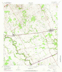
1958 Map of Marion
USGS Topo · Published 1961About this map
Marion and Cibolo serve as the primary hubs along this segment of the Southern Pacific railroad corridor in the late 1950s. The landscape is defined by the winding course of Cibolo Creek and its sharp meander at Crescent Bend, creating a natural boundary between Guadalupe and Bexar counties. This rural Texas environment is deeply rooted in local community institutions, evidenced by the presence of St Paul Ch, Lower Valley Sch, and the Slappers Cem.
Find a feature on this map
16 named features on this map. Tap any name to fly to it.
Don’t see what you’re looking for? This feature index may not catch every label — zoom into the map to look around manually.
Map Details
Editions of this 1958 Marion Map
2 editions found
Other maps of this area

1924 · New Braunfels No 4
USGS Topo · 1:48,000

1925 · New Braunfels No 1
USGS Topo · 1:48,000

1927 · New Braunfels
USGS Topo · 1:62,500

1953 · Schertz
USGS Topo · 1:24,000

1953 · Bat Cave
USGS Topo · 1:24,000

1953 · Martinez
USGS Topo · 1:24,000

1954 · San Antonio
USGS Topo · 1:250,000

1957 · San Antonio
USGS Topo · 1:250,000

1957 · New Berlin
USGS Topo · 1:24,000
1958 · New Braunfels East
USGS Topo · 1:24,000