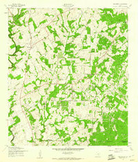
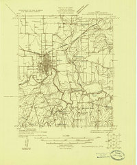
1957 Map of New Berlin
USGS Topo · Published 1961About this map
New Berlin anchors this mid-century survey of the Guadalupe County countryside, showing a landscape defined by small rural community centers and a growing petroleum industry. Scattered across the terrain are several legacy institutions essential for family history research, including the Sweet Home Sch, the Linne Cem, and both the Oak Creek Ch and Elm Creek Ch. The presence of numerous Oil Wells and larger clusters of Oil Wells indicates the economic shift occurring in this part of Texas during the late 1950s. Waterways like Cibolo Creek and Elm Creek wind through the area, while the boundaries of Bexar and Wilson counties intersect at the southern and western edges of the sheet. This map serves as a detailed record of local topography just before modern expansion began to alter the character of these small settlements.
Find a feature on this map
15 named features on this map. Tap any name to fly to it.
Don’t see what you’re looking for? This feature index may not catch every label — zoom into the map to look around manually.
Map Details
Editions of this 1957 New Berlin Map
2 editions found
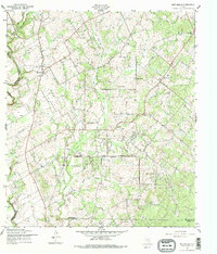
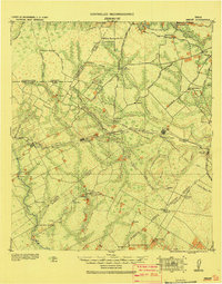
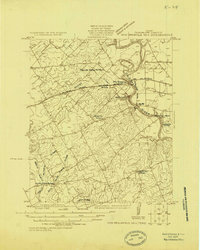
Other maps of this area

1911 · San Marcos
USGS Topo · 1:125,000

1919 · San Marcos
USGS Topo · 1:125,000
1920 · Smiley
USGS Topo · 1:125,000
1924 · New Braunfels No 4
USGS Topo · 1:48,000
1924 · San Marcos 3-c
USGS Topo · 1:48,000
1927 · New Braunfels
USGS Topo · 1:62,500
1930 · Seguin
USGS Topo · 1:62,500
1942 · Dewville
USGS Topo · 1:62,500

1953 · Seguin
USGS Topo · 1:250,000

1954 · San Antonio
USGS Topo · 1:250,000