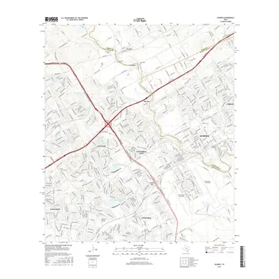
2016 Map of Schertz
USGS Topo · Published 2016About this map
The growing suburban corridor northeast of San Antonio is captured here, centered on the expansion of Schertz, Universal City, and Selma. This landscape is heavily defined by the footprint of Randolph Air Force Base, with its distinctive circular road layout including W Perimeter Rd and E Perimeter Rd. Despite the increasing residential development and the busy transit lines like the I-35 Frontage, the map preserves many older local landmarks. Genealogists can locate numerous small burial sites, such as Wheeler Cem and Sahm Cem, which appear alongside newer memorial sites like Chapel Hill Memorial Gardens. Natural features like Cibolo Cr and the Soil Conservation Service Site 5 Reservoir provide the primary drainage and recreation points for the surrounding communities of Live Oak and Converse.
Find a feature on this map
53 named features on this map. Tap any name to fly to it.
Don’t see what you’re looking for? This feature index may not catch every label — zoom into the map to look around manually.
Map Details
Editions of this 2016 Schertz Map
This is the sole edition of this map. No revisions or reprints were ever made.
Other maps of this area

1927 · New Braunfels
USGS Topo · 1:62,500

1953 · Schertz
USGS Topo · 1:24,000

1953 · Bulverde
USGS Topo · 1:24,000

1953 · San Antonio East
USGS Topo · 1:24,000

1953 · Bat Cave
USGS Topo · 1:24,000

1953 · Longhorn
USGS Topo · 1:24,000

1953 · Martinez
USGS Topo · 1:24,000

1954 · San Antonio
USGS Topo · 1:250,000

1957 · San Antonio
USGS Topo · 1:250,000

1958 · Marion
USGS Topo · 1:24,000