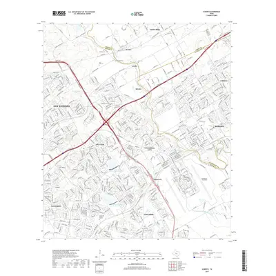
2019 Map of Schertz
USGS Topo · Published 2019About this map
Randolph Air Force Base anchors the southeastern landscape of this suburban and rural corridor northeast of San Antonio. The map documents a complex network of communities where modern infrastructure meets historic landmarks, spanning three county lines. The transition from the residential street grids of Universal City, Live Oak, and Schertz to the more open lands of Garden Ridge and Bracken is visible, defined by the major arteries of I-35 and Loop 1604. Geologic and water features like Cibolo Creek and Womans Hollow Creek cut through the terrain, while numerous small burial grounds, including Davenport Cemetery and Sahm Cemetery, provide essential points of reference for genealogists tracking families in the area north of Converse.
Find a feature on this map
80 named features on this map. Tap any name to fly to it.
Don’t see what you’re looking for? This feature index may not catch every label — zoom into the map to look around manually.
Map Details
Editions of this 2019 Schertz Map
This is the sole edition of this map. No revisions or reprints were ever made.
Other maps of this area

1927 · New Braunfels
USGS Topo · 1:62,500

1953 · Schertz
USGS Topo · 1:24,000

1953 · Bulverde
USGS Topo · 1:24,000

1953 · San Antonio East
USGS Topo · 1:24,000

1953 · Bat Cave
USGS Topo · 1:24,000

1953 · Longhorn
USGS Topo · 1:24,000

1953 · Martinez
USGS Topo · 1:24,000

1954 · San Antonio
USGS Topo · 1:250,000

1957 · San Antonio
USGS Topo · 1:250,000

1958 · Marion
USGS Topo · 1:24,000