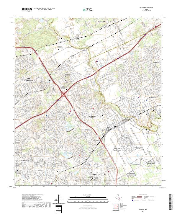
2022 Map of Schertz
USGS Topo · Published 2022About this map
Randolph Air Force Base dominates the landscape of this region, sitting at the junction of Bexar Co and Guadalupe Co. The map reveals a dense network of suburban growth and military infrastructure northeast of San Antonio, where the Missouri Pacific Railroad cuts through established communities like Selma, Schertz, and Cibolo. A remarkable concentration of historic burial sites, including the Our Lady of Perpetual Help Cem Number One and Schneider Memorial Cem, provides significant data for genealogical research.
Find a feature on this map
60 named features on this map. Tap any name to fly to it.
Don’t see what you’re looking for? This feature index may not catch every label — zoom into the map to look around manually.
Map Details
Editions of this 2022 Schertz Map
This is the sole edition of this map. No revisions or reprints were ever made.
Other maps of this area

1927 · New Braunfels
USGS Topo · 1:62,500

1953 · Schertz
USGS Topo · 1:24,000

1953 · Bulverde
USGS Topo · 1:24,000

1953 · San Antonio East
USGS Topo · 1:24,000

1953 · Bat Cave
USGS Topo · 1:24,000

1953 · Longhorn
USGS Topo · 1:24,000

1953 · Martinez
USGS Topo · 1:24,000

1954 · San Antonio
USGS Topo · 1:250,000

1957 · San Antonio
USGS Topo · 1:250,000

1958 · Marion
USGS Topo · 1:24,000