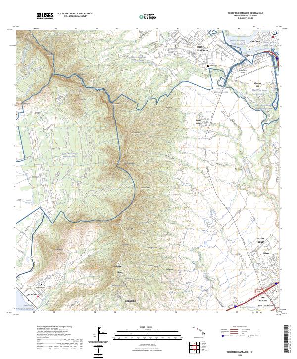
2024 Map of Schofield Barracks
USGS Topo · Published 2024About this map
Wai'anae Range peaks, including Pu'ukalena and Pu'uhapapa, dominate the western landscape of this Oahu survey. The steep terrain of Nānākuli Valley and Pōhākea Pass separates the coastal settlement of Nanakuli on the Pacific Ocean from the inland military and residential centers. Central to the region's operations are Schofield Barracks and Wheeler Army Airfield, alongside specialized installations like the USA Field Station Kunia and the Tropic Regions Test Center.
Find a feature on this map
174 named features on this map. Tap any name to fly to it.
Don’t see what you’re looking for? This feature index may not catch every label — zoom into the map to look around manually.
Map Details
Editions of this 2024 Schofield Barracks Map
This is the sole edition of this map. No revisions or reprints were ever made.
Other maps of this area

1953 · Haleiwa
USGS Topo · 1:24,000

1953 · Schofield Barracks
USGS Topo · 1:24,000

1953 · Ewa
USGS Topo · 1:24,000

1953 · Puuloa
USGS Topo · 1:24,000

1953 · Hauula
USGS Topo · 1:24,000

1954 · Oahu
USGS Topo · 1:250,000

1954 · Waianae
USGS Topo · 1:24,000

1954 · Kaena
USGS Topo · 1:24,000

1954 · Waipahu
USGS Topo · 1:24,000

1959 · Waipahu
USGS Topo · 1:24,000