
1953 Map of Schofield Barracks
USGS Topo · Published 1955About this map
The Waianae Range dominates this mid-century view of central Oahu, creating a high-elevation spine that separates the interior plateau from the coast at Nanakuli. During this period, the military footprint is extensive, centered on the Schofield Barracks Military Reservation and the adjacent Wheeler Air Force Base. These installations, combined with the Wahiawa Homesteads and the irrigation infrastructure of the Waiahole Ditch, illustrate the complex balance between defense needs and agricultural land use in Hawaii.
Find a feature on this map
66 named features on this map. Tap any name to fly to it.
Don’t see what you’re looking for? This feature index may not catch every label — zoom into the map to look around manually.
Map Details
Editions of this 1953 Schofield Barracks Map
This is the sole edition of this map. No revisions or reprints were ever made.
Other maps of this area

1953 · Haleiwa
USGS Topo · 1:24,000

1953 · Ewa
USGS Topo · 1:24,000

1953 · Puuloa
USGS Topo · 1:24,000

1953 · Hauula
USGS Topo · 1:24,000

1954 · Oahu
USGS Topo · 1:250,000

1954 · Waianae
USGS Topo · 1:24,000

1954 · Kaena
USGS Topo · 1:24,000

1954 · Waipahu
USGS Topo · 1:24,000

1959 · Waipahu
USGS Topo · 1:24,000
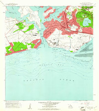
1959 · Puuloa
USGS Topo · 1:24,000