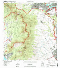
1998 Map of Schofield Barracks
USGS Topo · Published 2000About this map
The Waianae Range forms the dramatic backbone of this Central Oahu landscape, separating the military installations and agricultural plains to the east from the coastal valleys to the west. Significant defense infrastructure dominates the northern and eastern reaches, including Schofield Barracks and Wheeler Air Force Base, while the Naval Reservation occupies much of the interior Lualualei area. The complex network of ridges and gulches is punctuated by notable summits such as Pu'ukaua and Pu'ukalena, which served as critical landmarks for early surveyors and residents alike.
Find a feature on this map
83 named features on this map. Tap any name to fly to it.
Don’t see what you’re looking for? This feature index may not catch every label — zoom into the map to look around manually.
Map Details
Editions of this 1998 Schofield Barracks Map
This is the sole edition of this map. No revisions or reprints were ever made.
Other maps of this area

1953 · Haleiwa
USGS Topo · 1:24,000

1953 · Schofield Barracks
USGS Topo · 1:24,000

1953 · Ewa
USGS Topo · 1:24,000

1953 · Puuloa
USGS Topo · 1:24,000

1953 · Hauula
USGS Topo · 1:24,000

1954 · Oahu
USGS Topo · 1:250,000

1954 · Waianae
USGS Topo · 1:24,000

1954 · Kaena
USGS Topo · 1:24,000

1954 · Waipahu
USGS Topo · 1:24,000

1959 · Waipahu
USGS Topo · 1:24,000