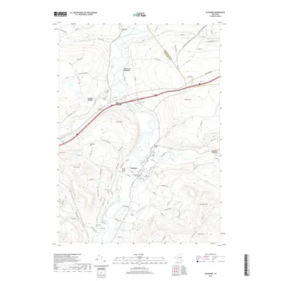
2019 Map of Schoharie
USGS Topo · Published 2019About this map
Schoharie Creek dictates the movement of this New York landscape, carving a wide valley between the steep rises of Terrace Mtn and Barton Hill. The settlement of Schoharie serves as a focal point, anchored by the Schoharie County Courthouse and the site of the Old Stone Fort Cem. The map illustrates a high density of early burial grounds and civic landmarks concentrated near the water, while the uplands transition into the more isolated peaks of Cotton Hill and Rundy Cup Mtn. Transportation history is visible at Schoharie Junction, where rail and road paths intersect near the confluence of the creek and Cobleskill Creek. To the north and west, the smaller settlements of Central Bridge and Oak Hill sit alongside the winding path of Fly Cr, reflecting a traditional Mohawk Valley development pattern where towns cling to the fertile lowlands while ridges remain sparsely populated.
Find a feature on this map
107 named features on this map. Tap any name to fly to it.
Don’t see what you’re looking for? This feature index may not catch every label — zoom into the map to look around manually.
Map Details
Editions of this 2019 Schoharie Map
This is the sole edition of this map. No revisions or reprints were ever made.
Other maps of this area

1895 · Amsterdam
USGS Topo · 1:62,500

1896 · Fonda
USGS Topo · 1:62,500

1898 · Fonda
USGS Topo · 1:62,500

1898 · Schoharie
USGS Topo · 1:62,500

1900 · Schoharie
USGS Topo · 1:62,500

1900 · Schoharie
USGS Topo · 1:31,680

1900 · Berne
USGS Topo · 1:62,500

1902 · Fonda
USGS Topo · 1:62,500

1903 · Berne
USGS Topo · 1:62,500

1931 · Amsterdam
USGS Topo · 1:62,500