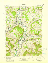
1946 Map of Schoharie
USGS Topo · Published 1946About this map
Schoharie and its surrounding river valley define this 1940s landscape, where the confluence of Schoharie Creek and Fox Creek supported generations of settlement. The presence of the Old Stone Fort serves as a significant landmark for local history, standing near the heart of the village. The terrain transitions from the alluvial flats of the creek to the prominent heights of Barton Hill and Terrace Mtn, with the valley floor serving as a critical corridor for the Delaware and Hudson railroad.
Find a feature on this map
48 named features on this map. Tap any name to fly to it.
Don’t see what you’re looking for? This feature index may not catch every label — zoom into the map to look around manually.
Map Details
Editions of this 1946 Schoharie Map
This is the sole edition of this map. No revisions or reprints were ever made.
Other maps of this area

1895 · Amsterdam
USGS Topo · 1:62,500

1896 · Fonda
USGS Topo · 1:62,500

1898 · Fonda
USGS Topo · 1:62,500

1898 · Schoharie
USGS Topo · 1:62,500

1900 · Schoharie
USGS Topo · 1:62,500

1900 · Schoharie
USGS Topo · 1:31,680

1900 · Berne
USGS Topo · 1:62,500

1902 · Fonda
USGS Topo · 1:62,500

1903 · Berne
USGS Topo · 1:62,500

1931 · Amsterdam
USGS Topo · 1:62,500